Document Type
Report
Title
Dickey-Lincoln School Lakes Project at Dickey, Maine : Final Environmental Statement, Volume 1-4
Publisher
The Corps
Rights and Access Note
Rights assessment remains the responsibility of the researcher. No known restrictions on publication. For information about the process and fees for obtaining higher resolution scans or another file format, contact Special Collections.
Publication Date
1981
Publisher location
Waltham, MA
Abstract/ Summary
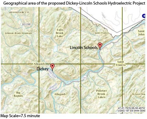
The proposed Dickey-Lincoln School Lakes Project in northern Maine is a multipurpose installation on the St.John River. The combination hydroelectric power and flood control project is located in Aroostook County, Maine, near the Canadian border. The two proposed earth fill dams located at Dickey are 10,200 feet in length with a maximum height of 335 feet. They would impound 7.7 million acre feet of water at a maximum pool elevation 910 feet mean sea level. A second earth filled dam located 11 miles downstream at Lincoln School would serve as a regulatory dam. It would be 2100 feet in lenqth, 90 feet above the existing streambed.
Repository Citation
U. S. Army Engineer Division and New England, "Dickey-Lincoln School Lakes Project at Dickey, Maine : Final Environmental Statement, Volume 1-4" (1981). Dickey-Lincoln School Lakes Project. 87.
https://digitalcommons.library.umaine.edu/dickey_lincoln/87
Citation/Publisher Attribution
United States. 1978. Dickey-Lincoln School Lakes Project at Dickey, Maine: final environmental statement. Waltham, Mass: The Corps.
Version
publisher's version of the published document
Final_EIS_1978_v1
Final_EIS_1978_v2.pdf (47877 kB)
Final_EIS_1978_v2
Final_EIS_v4.pdf (19728 kB)
Final_EIS_v4
Included in
Architectural Engineering Commons, Climate Commons, Energy Policy Commons, Environmental Indicators and Impact Assessment Commons, Environmental Policy Commons, Fresh Water Studies Commons, Geography Commons, History Commons, Natural Resources Management and Policy Commons, Other Forestry and Forest Sciences Commons, Other Public Affairs, Public Policy and Public Administration Commons, Power and Energy Commons, Statistics and Probability Commons, Terrestrial and Aquatic Ecology Commons


